Geospatial Markers – AppAR
The company Kredo was looking for help building a proof of concept for an AR mobile app aimed at the real estate market.
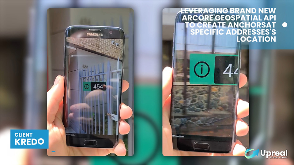
The idea behind the application is to allow users to see more information about a property when walking around (without having to go to a website each time).
They already tried with other developers in the past, but they couldn’t figure out a way to achieve the desired accuracy for the AR markers.
The AR markers needed to match the physical location of the property which is not feasible when using GPS on its own.
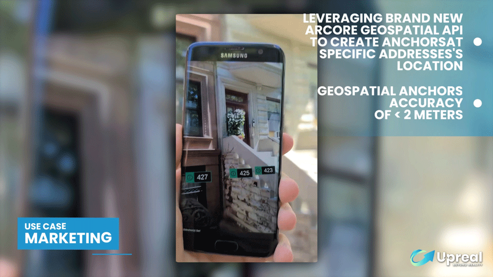
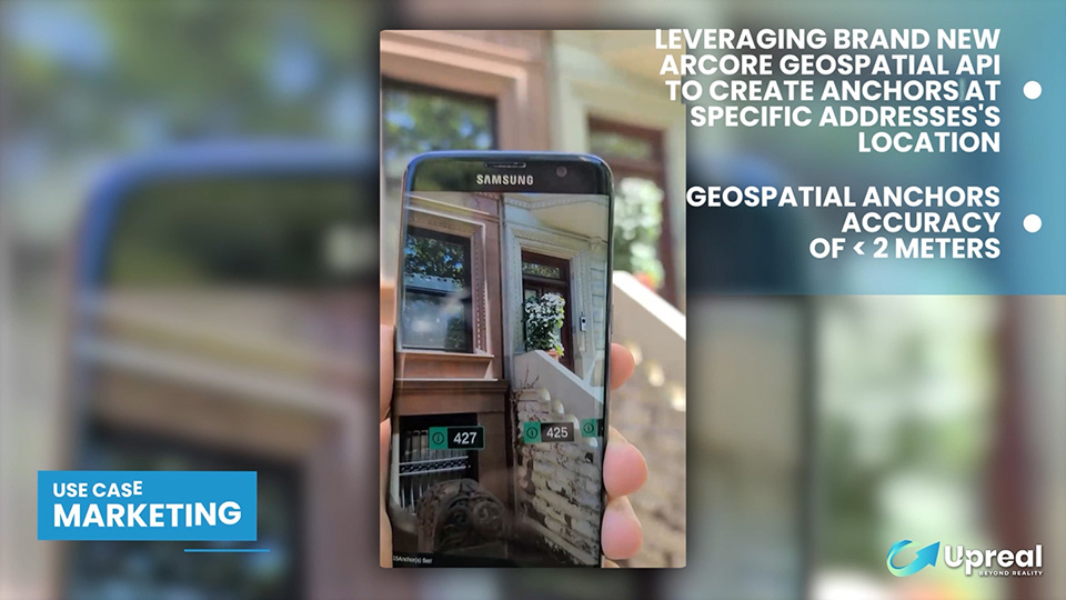
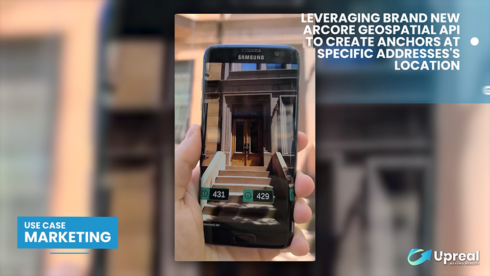
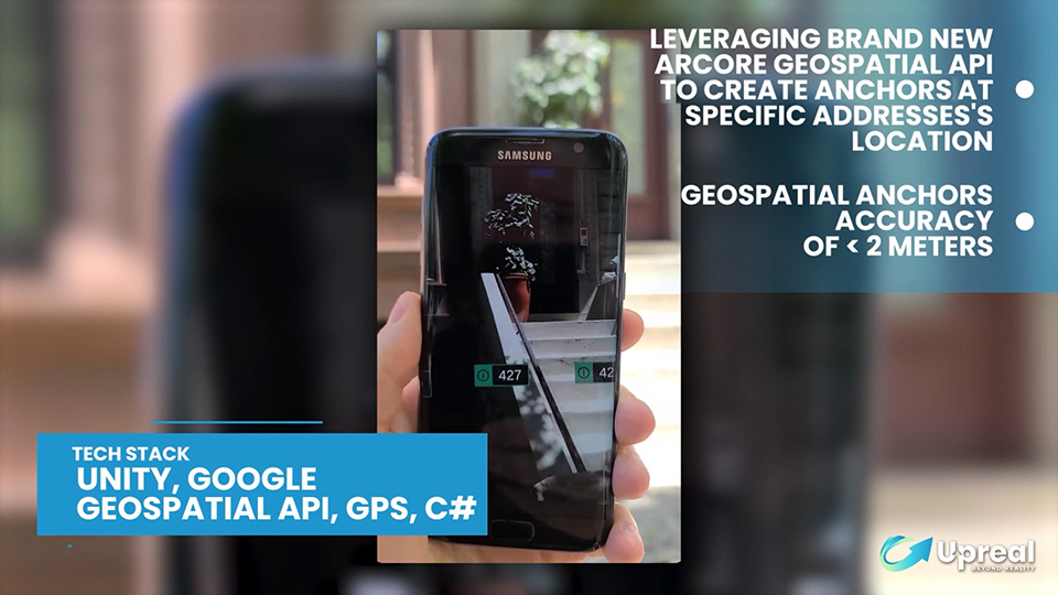
So we came up with the solution of using Google’s recent technology called “Geospatial API”.
This tech allows you to determine the precise location of a user’s device by using a combination of the device’s sensor, GPS data, and Google’s Visual Positioning System (VPS).
This new technology gave us a precision of under 2m, which was precise enough for our use-case.

CLIENT
PLATFORM
SERVICES
OBJECTIVE
- Build a proof of concept for a real-estate AR mobile application
- Improve the accuracy of their first implementation of this idea
- Show markers on top of buildings that stay on the building, and don’t wander off into the distance
RESULTS
- Created an AR mobile app prototype where you can see large markers on top of buildings
- Improved the accuracy of the geolocation from 20m to 2m using Google API
- Markers stay in place and don’t jump around constantly like in their previous test using GPS only
Serious about your AR/VR Project?
Book a discovery call and speak directly with one of our AR/VR expert